


Goering Ranches / Chocheta Estates
Identifier
Surface Type
Runway L × W
Elevation
Fuel
From City
50OR
GRAVEL
5500 ft. x 60 ft.
3450
NONE
18 miles ENE of BEND, OR
⌂ Residential airpark | Not all hangars or buildings allow residential use. Verify the property.

The Nation’s Leader in Aviation Real Estate
Oregon Aviation Real Estate is a directory of Oregon airparks. This site is part of the Aviation Real Estate network. Brokers interested in this state site: visit TakingOffSolutions.com.
Private-airpark tours by prior arrangement.
Talk about airpark community life.
Compare your home, hangar and access priorities.
Current Listings
Market Report
Getting Around from Goering Ranches / Chocheta Estates

Airport Distances (straight line, FAA coordinates)
Roberts Field/Redmond Municipal (RDM): 14.8 mi / 12.8 NM
Mahlon Sweet Field (EUG): 112.4 mi / 97.6 NM
Mcnary Field (SLE): 115.8 mi / 100.6 NM
Portland International (PDX): 130.9 mi / 113.8 NM
Boise Air Terminal/Gowen Field (BOI): 238.3 mi / 207.1 NM
Nearby Fuel (FAA, nearest public-use airports)
Bend Municipal (BDN): 10.9 NM, 100LL and Jet A, attended Sat-Sun 0800-1700; attended Mon-Fri 0730-1800
Prineville (S39): 11.6 NM, 100LL and Jet A, attended Sat-Sun 0900-1400; attended Mon-Fri 0800-16:30
Roberts Field/Redmond Municipal (RDM): 12.8 NM, 100LL, Jet A and MOGAS, attended daily 0400-2000
Confirm fuel availability and hours with the airport before flight. FAA NASR data effective 10/01/2026.
Weather & Flying Conditions
Explore the Goering Ranches / Chocheta Estates forecast, forecast winds, radar and official pilot-weather resources. Load the latest outlook below; check each source’s location and issue time.
Local Forecast uses airpark coordinates, not an on-site observation. Nearby Pilot Weather opens the AWC map; select a reporting station. Radar opens the NWS map. Climate History opens NOAA records; choose a station and date range. Reference only, not a pilot weather briefing.
Nearby Flying Info
Review the FAA Operations, Communication, Weather and Runway tabs below. Confirm current fuel availability, airport access, NOTAMs and weather before departure. This page is a real estate reference, not a flight briefing or permission to land.
Aeronautical Information Services
50OR
Data Effective:
0901Z 10/01/26 to 0901Z 10/29/26
Goering Ranches / Chocheta Estates
Bend
OR
LAT / LONG
ELEVATION (FT)
VARIATION
FROM CITY
ARTCC
SECTION CHART
TIME ZONE
44-05-50.441 N / 120-56-50.068 W
3450
18 E 1985
18 miles ENE of BEND, OR
ZSE
Klamath Falls
America/Los_Angeles
Loading FAA airport data...
Please wait while the connected data loads.
Goering Ranches / Chocheta Estates (50OR) at a Glance
FAA airport record, data effective 10/01/26. Privately owned, private use.
Location: Crook County, 18 miles ENE of Bend, Oregon. Field elevation 3450 ft.
Runway 17/35: 5,500 x 60 ft gravel, condition listed as good.
FAA remarks (as published): PVR USE ONLY; AGREEMENT WITH BOWEN ARPT REGARDING COMMON TFC PATTERN & RDO COMMS DURG SIMULTANEOUS OPNS. PERSONAL USE. FOR CD CTC SEATTLE ARTCC AT 253-351-3694.
Attended all hours Monday through Friday.
Airport activated: July 1984.
About this page: Oregon Aviation Real Estate is a directory of Oregon airparks, not a real estate for-sale site. No property listing is offered on this page. Goering Ranches / Chocheta Estates is a private-use airport, so prior permission is required. Always confirm current FAA data, NOTAMs and airport permission before you fly.
FAA Sectional Charts · Goering Ranches / Chocheta Estates (50OR)
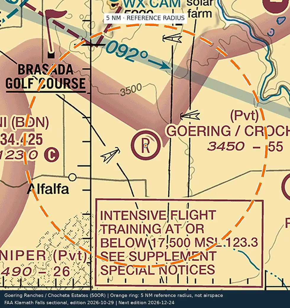
10/29/26 to 12/24/26 Not for navigation. Source: FAA sectional chart.

10/29/26 to 12/24/26 Not for navigation. Source: FAA sectional chart.

10/29/26 to 12/24/26 Not for navigation. Source: FAA sectional chart.

10/29/26 to 12/24/26 Not for navigation. Source: FAA sectional chart.